Saturday, November 15, 2014

Coast to Coast

It's late May 2014 and I finally had a chance to finish off my journey.  This time with my good buddy Lorne.  The route we sort-of planned was to head to the Ferry terminal at Horseshoe Bay via the Duffy Lake Road, through Lilloet, then head either to Vancouver Island or the Sunshine Coast.  Sky were threatening but the rain held off until the afternoon, right at the start of the Duffy Lake Road.  This road is one gem of a motorcycle adventure with one twisty after another.  On a dry day you can clip along at a pretty good clip.  Not so when it's pouring rain.  It finally stopped briefly between Pemberton and Whistler only to start up again all the way to the Ferry terminal.  I had decided along the way that the best way to go was to head to Vancouver Island straight away.  I knew what time the Ferry departed and it was going to be tight, very tight.  We zoomed in to the terminal with minutes to spare and loaded to Nanaimo, the very last vehicles to load.  The ticket agent was very accommodating and had the Ferry loaders wait for us. 
Last on
We road the rest of the evening in the rain to Parksville. 

The morning brought gray skies but no rain. About 10 k's up the road from Parksville is the small town of Coombs, famous for goats living on the roof.  I had been there years ago when my daughter was just a baby.  Apart from the building being more of a tourist attraction, it was much the same.

Lorne in awe

Except for a brief shower, the rain not only held off for the rest of the day but also for the rest of our adventure on the Island.   Hwy 4 to Port Alberni was okay but the fun started after that and didn't end until Tofino.  What a great motorcycle road!  We set up camp in Pacific Rim National Park before we took off to Tofino, but Lorne had battery issues and had me push starting his bike.  This reminded me of when I couldn't get my bike started in Quebec.  I did get that problem resolved with diagnostic help from Lorne but not after spending a bunch of money at the dealer in Kelowna to have them resolve it.  As it turns out, it was a simple solution.  Replace the worn out on/off started switch. 
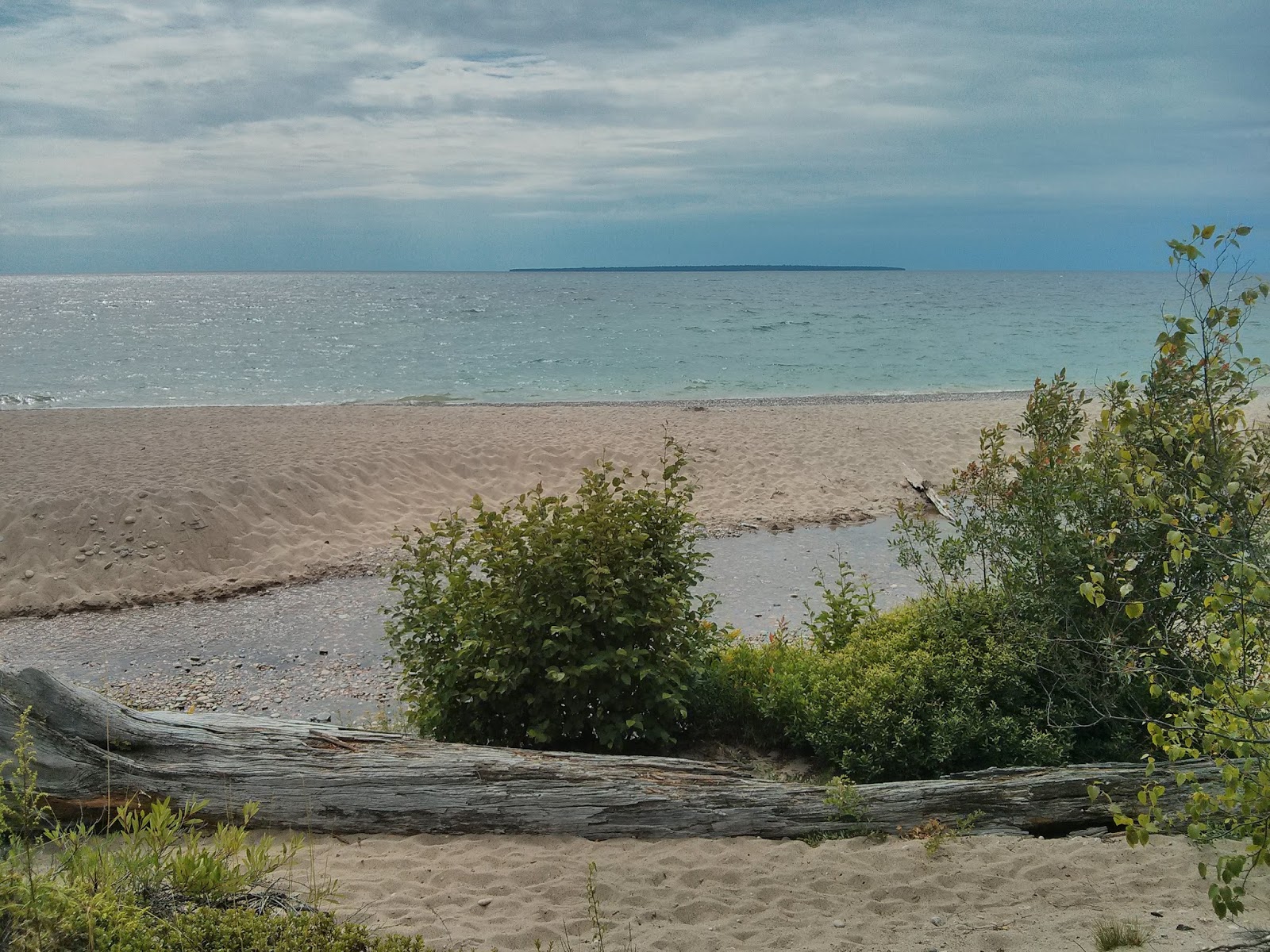
After a tasty pub lunch and some running around Tofino looking to resolve Lorne's battery problem, we headed back to our campsite.  It was a short walk from our spot to the beach.  Armed with my camera, the evening was shaping up just perfect for sunset photos.
 I had finally completed what I had set out to do, see the sunrise at the furthest point east in Newfoundland, Cape Spear then ride across Canada to catch the sunset on the west coast.  Now I know that Tofino isn't the furthest point west. That distinction goes to any point along the Yukon/Alaska border, which I had also been to,  but for this ride it was to be from the Atlantic to Pacific oceans. 
Quick snack in Port Alberni
The next morning we stopped in at Ucluelet (pronounced you-clue-let) for breakfast then headed back to Parksville, south to Chemainus for yet another pub lunch, then off to Port Renfrew along the oh-so-cool Pacific Marine Road.  Not much happening in Port Renfrew that time of the year.  It's main starting point for hikers doing the West Coast Trail.  After a pub dinner (what else!) we crashed at a very expensive motel, of which we were the only ones there.  The morning brought good skies for a spirited run south on Hwy 14 to Sooke.  We met Kirsty, a family friend, at a pub in Victoria for lunch then off around Victoria on a sightseeing tour.
We called it an early night and stayed at this nice motel in Sydney, close to the Ferry terminal. 


Tree-hugger Lorne
Our trusty rides


Monday, August 12, 2013

Last Day (This Portion)


I took the hwy 1A, the backway into Canmore, about 20 kms. I had an opportunity to check out some of the damage done by the floods earlier in the summer. The province has done an amazing job of opening up washed out bridges and cleaning up trees that had swept down. 

With the sole intention of getting home asap, one again I was forced to take the TCH.  What a nightmare.  Lines of cars as far as you can see.  What is it with drivers who do under the speed limit on a 2 lane stretch only to come across a passing lane then speed up to 140!  That pisses me off to no end!!  The drive was frustrating, annoying and aggravating albeit the most scenic.  I rolled into Vernon around 2, very hot and tired.  Good to be home.

Unfortunately, I really haven't completed the point of the trip, that is to go from coast to coast.  Although I had enough time to make it to Tofino, I needed to spend some of my remaining days off doing much needed chores around the house and more importantly, spend time with Tina.  The "bee-sting" in my neck was also getting worse and worse.  The motorcycle was up to its old tricks again by not starting.  I'm thinking its got something to do with the hot temperatures as it started not starting again as soon as I hit the hot temps in the Okanagan. 

I will, early in the 2014 riding season, complete my trip and head west to catch a sunset in Tofino. 

Corner Gas

 
Corner Gas ran on CTV between 2004-2009 but still remains one of my favorite shows.  The show was filmed entirely in Saskatchewan with the interior scenes shot in Regina and all the outdoor shots filmed on location in Rouleau, Sask.  As luck would have it, Rouleau was a short ride up Hwy 39 from Weyburn.  The gas station and the "Ruby" was just a set and after the filming had stopped, quickly fell into disrepair.  It was bought privately and somewhat restored.  The gas station is now a souvenir shop but the interior of the Ruby seems to be a work in progress.  It never was a functioning restaurant so to feed the tourists, a food truck now sits out front.  I knew all that ahead of time but I was still very excited to see it. 
Waiting for service (the pumps don't really work)

The grain elevator was re-painted to Dog River and the Hotel hasn't changed but other than that, the Rouleau is back to normal.  I'm not sure if the Hotel is either a hotel or bar today.

Exterior shots of the DRPD
Original DRPD police cruiser.
Only one criticism about my visit.  I realize that working in the gift shop is just a part time, possible a summer job, but get someone in there with a little personality! 
 
After that, I set out to Cypress Hills Provincial Park, Alberta side.  Unfortunately, Rouleau is situated fairly close to the Trans Canada Highway (TCH) so I couldn't really avoid it.  The day was cool and clear and surprisingly calm, a great day to cruise.  I stopped for quick lunch in Swift Current and hit the road again. 
 
Health wise, I had been feeling pretty good but was starting to feel a bit beat up and the constant "bee sting" in my neck and shoulder area was taking its toll.  I made it to the turn-off the Cypress Hills fairly early in the afternoon (cruising at an ave. of 120 kph) so I had a decision to make.  Spend an extra day there, or start hammering it back home.  If I get to at least Calgary, I would get home the next day.  I kept hammering.
I was getting tired so I needed a few extra breaks, one of which was Medicine Hat, home of the worlds largest tee-pee.
Tee-Pee in Medicine Hat
I thought about hoteling it in Calgary so I stayed on the TCH through town.  Big mistake.  The traffic was insane later to find out there was a Stampeder's football game happening that night and I had to ride right by the stadium. I checked out one hotel that I've stayed at before for Ringette tournaments but they wanted $168.  Screw that!  Away I went.  The next trick was finding a camping spot before I got to Banff. (didn't want to pay the park fees)  Based on the volume of traffic and the speed of people pulling all sorts of campers, I was starting to get worried that I won't find a campground.  I did, at Bow Valley Provincial Park. 

Thursday, August 08, 2013

Zipping Across the Prairies


Today was the longest ride I've ever done on a motorcycle.  I started out in Kenora, Ontario and ended up in Weyburn, Saskatchewan.  According to Google Maps, that's 713 km's. In order to stay off of the Trans Canada as much as possible, I had to stay on it as far as Winnipeg, no other option.  From there I branched south and took highway 2 across Manitoba.  The speed limit was the same as the TCH but virtually no traffic and more to see.  Hwy 2 is, nevertheless, very flat and very straight.  I stopped at a small town, the name escapes me, to get gas and snacks. Their sign claims the coldest beer on Hwy 2. 
 
How could they possibly make that claim.  You just don't kid about something like that! When I confronted the gas station attendant, he confidently said that it is in fact, true.  The real truth is that they're the only place where you can buy beer on Hwy 2.  There are a few places off the main road but not on it.  Truth in advertising. 

A bit later on, I stopped at another small town, Souris Manitoba, for gas and lunch.  The Subway lady there asked if I've checked out their new suspension bridge which she claimed is the longest pedestrian suspension bridge in the world.  I have my doubts about that claim, possibly the longest one in Manitoba.  There just isn't that many places that need spanning in that province.
 

Before I set out on this adventure, there were some places that I had to visit:
  • Cape Spear in Newfoundland. 
  • L'Anse aux Meadows, Newfoundland
  • The Cabot Trail
  • Confederation Bridge linking New Brunswick and PEI.
  • St Lambert, Quebec.  The town where I grew up.
  • The Terry Fox Memorial in Thunder Bay
  • Camping in Cypress Hills Provincial Park (long story)
  • And, the most important of the all, Rouleau Sask.  What's in Rouleau you ask?  Only the small town where Corner Gas was filmed.  Hello! Dog River!

Wednesday, August 07, 2013

The Long Haul Across Ontario, continues.


Ontario is a very wide province.  Very wide.  The weather certainly has been a challenge.  I set out from Wawa on Tuesday morning in very damp conditions so I put on all my rain gear and prepared for the worst.  To my surprise, the morning part of the ride wasn't half bad, until I got close to Lake Superior.  Then the fog rolled in.  I thought Halifax was bad, this was worse.  I knew I was getting close to the lakeside town of Marathon where I'd planned to wait until the fog lifted.  The only problem was, I missed the whole town.  I literally didn't see it and when I'd realized I missed the town I decided to keep going.  The fog cleared somewhat, just long enough to stop to take this picture.

Aguasabon River Gorge

Just past Nipigon the skies got very dark then opened up, a lot.  It poured all the way to Thunder Bay.  I made it into Thunder Bay around 4:30 and headed straight to a Honda dealer to do a quick oil change.  Then, still pissing out, I headed to yet another motel for a pizza and beer night. 
 
The morning brought clear skies but chilly temperatures.  Yesterday coming into Thunder Bay, I had stopped at the Terry Fox Monument but it was raining so hard I couldn't take a picture.  So, in the morning, I doubled back (about 10 k) to visit the memorial again.  The whole park is very impressive with an equally impressive tribute to Terry Fox.

Lou Grandell had suggested that I check out Kakabeka Falls, just west of Thunder Bay.  Great suggestion! 
Kakabeka Falls
I tossed a coin and decided to take Highway 11 through Atikokan to Fort Frances.  Very quiet highway but not a lot to look at apart from trees and more trees. 
There, I would have to make another route decision; skootch through the northern part of Minnesota to Manitoba or head up to Kenora along side of Lake of the Woods.  I choose Kenora.  My plan was to camp at Rushing River Provincial Park but.......it started raining out, again!  I'm now camping at the Super 8 in Kenora.  I'm going to have to do a lot of camping from here on.  Tomorrow, Manitoba! 
 

Monday, August 05, 2013

Lake Superior

h


Todays ride took me from Manitoulin Island, past Sault Ste. Marie to Wawa, home of many of the worlds largest geese, for some reason which I haven't yet discovered. There was no way I was going to make it to Thunder Bay.  It's a bloody long ways!  Wawa is only half way from Manitoulin Island.

 
The morning ride to The Soo was pretty boring skirting along Lake Huron with only a few glimpses.  It was in the afternoon when the scenery picked up. The highway took a turn north along the eastern shores of Lake Superior.  Every time I say "Lake Superior" it puts me in mind of a great Gordon Lightfoot song.  Hopefully tomorrows ride will give me lots of vistas of "Gitchi Gummi".
 

Sunday, August 04, 2013

The Long Haul Across Ontario

Saturday I said goodbye to Tina in Montreal after a week in Quebec.  I dropped off the rental car and picked up the bike from the Avis compound and it was then that I realized I'd left my motorcycle seat cover in the Delta Hotel in Montreal.  Sooo, back I went hopefully to retrieve it.  This time I was successful.  They had it and also had put the charger for my tablet in the same bag.  So now I have two. 

I've chosen what I think is a fairly direct route across Ontario while trying to avoid the major highways.  So far my route has be through Ottawa, Algonquin Provincial Park, Huntsville (the Muskoka's), Parry Sound (home of Bobby Orr), Sudbury (home of the world's largest nickel) and now to Manitoulin Island where I'm camping at Batman's Family Campground.  This being the August long weekend, camping spots are in short supply but they did manage to squeeze me in.  I've set up camp on the kids playground; not close by, but on it!  Hopefully it will quiet down later on.


I'm using a weak wifi signal here at the campground which doesn't allow me to download pictures.  Hopefully tomorrow I'll find a cafĂ© and get some pictures happening. 

I feel that my adventure is over and now it's just a question on hoofing it across country.  I haven't taken many pictures in the last couple of days and I have to change that.  I get in these grooves that I get focused on reaching a destination that I don't stop and smell the roses.  Tomorrow I hope to make it to Thunder Bay and do an oil change on the bike.